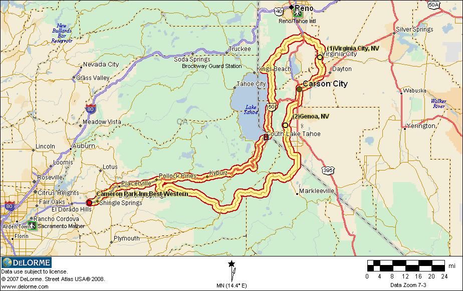
The “Sierra Nevada” edition of the TGPCHPCMY2KMR is based in Cameron Park, California and consists of 5 daily loops through the Sierra Nevada mountain range, starting and ending each day in Cameron Park. This edition is normally alternated with the Northern edition on even numbered years: 2008, 2012, 2014. The itinerary for this edition is below.
We will fine tune the itinerary as the ride gets closer. Please check back in late 2021 for a link to register for the ride so that I can keep you updated on the latest. And please sign the waiver.
Ride Bulletins:
- People must make their own reservations for the motel and for a campground. We suggest you do it two or three months prior to the ride, or sooner, to insure that accommodations are available. Links to everything close to Placerville can be found on the Itinerary page.
- We will have get-together dinners every night of the ride and lunches as feasible; see the dinner signup sheet on this web site for details – please signup so we can tell the restaurants what to expect.
- We will try to get a group photograph of as many of the riders and their bikes as possible on Monday morning along the way. We need to leave at 8:30AM sharp because Monday is a long day.
- TBD
- TBD
- TBD
Itinerary:
September [TBD] (Saturday and Sunday): Gather in Cameron Park
- Suggested Motel: Quality Inn in Cameron Park (shown on the map as “Best Western Cameron Park Inn”). Quality Inns web site is: www.qualityinn.com Email address for the Cameron Park unit is: qualityinn958 at gmail dot com Be sure to mention that you are part of the Pacific Coast Motorcycle Group when you make your reservations. The group rate is $77.00. Direct phone number is 530 677-2203.
- Gather for dinner at 7PM on Saturday at Original Mel’s Diner in Placerville
- Gather for dinner at 7PM on Sunday at Que Viva Restaurant in Cameron Park (walk from the motel)
- Featured Side Ride: Marshall Grade, Wentworth Springs Road, French Meadows Road, Mosquito Ridge Road, Old Foresthill Road, CA49, Lotus Road, Green Valley Road, Cameron Park Drive – to map and details 5 hours, 156 miles, 1000 to 1500 corners, depart 9:30AM Sunday
- Suggested side ride #2: One hour loop (Lotus Road, Marshall Grade Road, CA193, CA49, Lotus Road)
- Suggested side ride #3: Green Valley to Salmon Falls, back on 49
- Suggested side ride #4: South Shingle to Latrobe to Salmon Falls, to Green Valley, back to Cameron Park

Link to Quality Inns
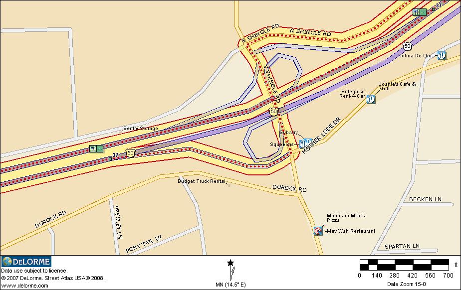
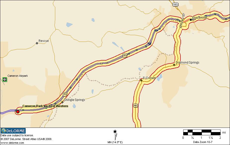
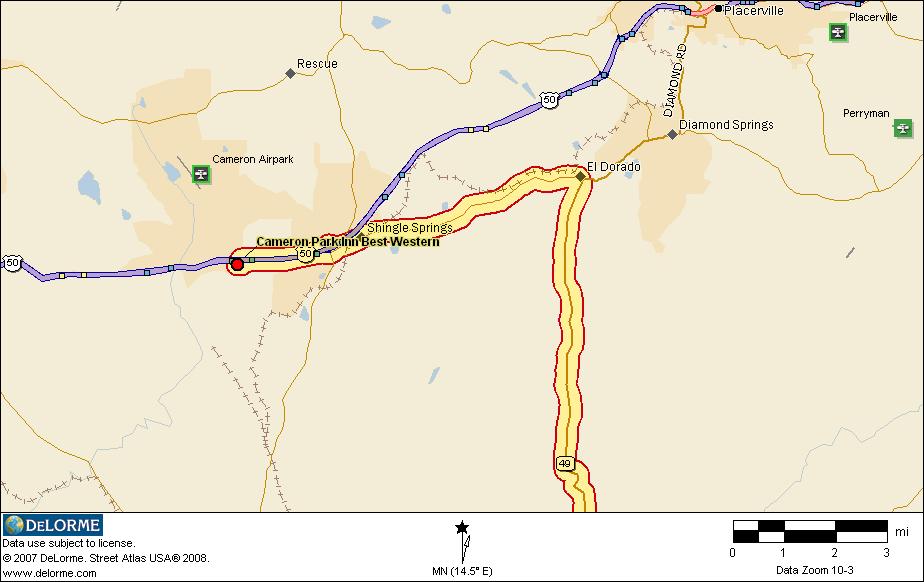
Up is north on this map. Coming up US50 from the west or the east, take Cameron Park Drive Exit.
From the west, turn right at the bottom of the off ramp (not on red though…). At the next light (Coach Lane), turn right again. About 200 yards down the street, on the right, is the motel.
From the east, turn left at the bottom of the off ramp. Go under the freeway through the light at the off ramp to the light at Coach Lane. Turn right and about 200 yards down the street, on the right, is the motel.
Be careful of the driveway. There is a sharp transition there. Take it easy and try to hit it as close to a right angle as possible. I don’t want to see anyone go down on that transition.
As you can see from the map note, there are 3 filling stations at the corner of Coach Lane and Cameron Park Drive.
There are also a number of restaurants in the immediate area including Applebee’s, Que Viva (excellent Mexican Restaurant), Denny’s, Sizzler, VIP Buffet (Chinese), Mongolian BarBQue.
There are also several fast food places: McDonald’s, Taco Bell, Carl’s Junior, Jim Boy’s Tacos and a Kentucky Fried Chicken on the other side of the freeway. There is a Baskin & Robbins (ice cream) associated with a Togo’s Sandwich shop and a Round Table Pizza.
There is a Safeway (supermarket) which is open 24 hours across the street from the Motel.
The official name and address is: Quality Inn & Suites, 3361 Coach Lane, Cameron Park, CA 95682. Phone is 530 677-2203. Fax is 530 676-1422.


Turn right at that stop sign, go to the next stop sign (100 feet) and continue on through it. You are now on the Georgetown main street which is also Wentworth Springs Road.

Continue on this Forest Service road, following the signs for French Meadows Reservoir. Portions of this road get very narrow and very rough. Almost as bad, in spots, as the Lost Coast route but not quite. And it is VERY winding. The corners are not marked at all so be CAREFUL; they can sneak up on you.
Upon reaching French Meadows Reservoir, we will stop for a butt break.
When we leave French Meadows Reservoir, we will cross the dam and be on Mosquito Ridge Road at that point. We will continue on Mosquito Ridge Road back to Foresthill. At the stop sign in Foresthill, turn left onto Foresthill Road.
Continue on Foresthill Road. If you reach the Foresthill high bridge, you have gone too far. The turnoff onto Old Foresthill Road sneaks up on you. Turn left onto Old Foresthill Road. It is marked and there is a left turn lane but I missed it today as I was approaching it. Had to make a U turn and come back.
At the bottom of Old Foresthill Road, you cross the American River on a bridge. Just beyond it is a turn to the left onto another bridge; that is CA49. Turn left onto CA49.
There is a stop sign in Cool. Continue straight on through it. 12 miles later, or so, we will encounter the same stop sign at Marshall Grade Road that we went through on the way out. Continue straight through that one too, cross the river and at the next stop sign, turn right. You are now on Lotus Road, heading back for US50 and the motel.
Go back through the Lotus Road, Green Valley Road interchange (the road swings to the right). After crossing a small bridge, the road turns left. At that point you are on North Shingle Road. Four miles down the road, you will reach a stoplight. Turn left there and immediately swing to the right to get onto the US50 westbound on ramp. The next exit is Cameron Park Drive and that is where we get off to return to the motel.
September 8th (Monday): Gather at Lake Don Pedro for group and bike photos.
- Leave Cameron Park, CA 8:30 AM – to Day 1 map and details
- Get on US50 East, go to the junction with CA49 in Placerville
- Head south (right) on CA 49, through several Mother Lode towns including Sonora and Chinese Camp.
- At Chinese Camp, turn left onto California Highway 120 toward Yosemite National Park
- At the Lake Don Pedro vista point, gather the bikes and people for a photo.
- Gas stop at Big Oak Flat.
- Proceed east through Yosemite and Tioga Pass to Lee Vining, Mono Lake and the junction with US395.
- Lunch at the Whoa Nellie Deli in Lee Vining
- Turn north on US395
- Gas stop in Walker.
- Stay on US395 until CA89.
- Over Monitor Pass, north thru Markleeville
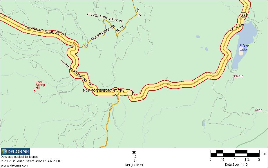
- West on 88 at Woodfords, over Carson Pass, turn right on Mormon Emigrant Trail
- Continue on Mormon Emigrant Trail to the junction with Sly Park Road. Turn right on Sly Park Road to US50
- Take US50 west to Cameron Park.
- Arrive Cameron Park, CA between 6 and 7PM.
- Enjoy the scenery
- Distance: 388 miles (9-10 hours*)
- Gather for dinner at 7PM at, Applebee’s, 3281 Coach Lane, Cameron Park, (530) 677-8677 (walk from the motel)


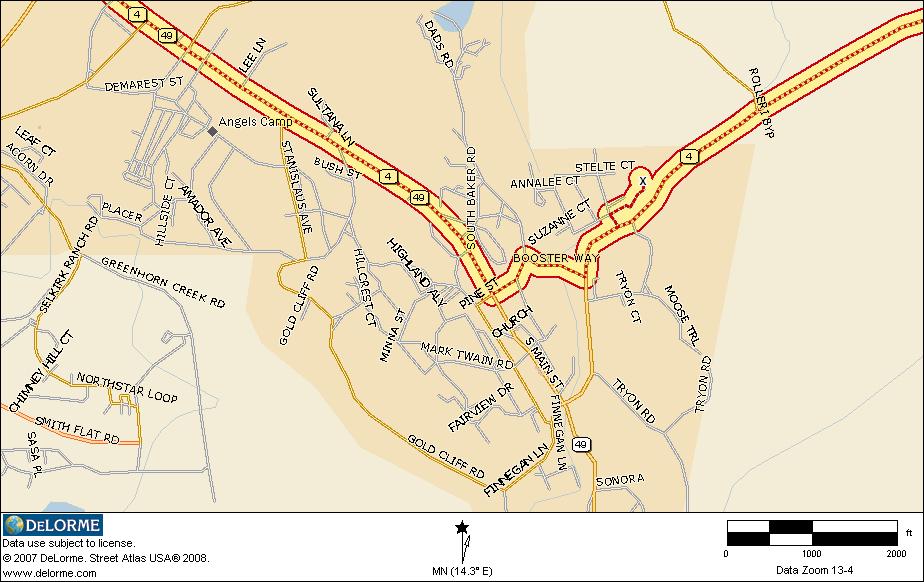
Continue on CA49 through Angel’s Camp, Tuttletown and on into Sonora. On main street in Sonora, you will come to a stoplight where CA49 turns to the right. Turn right and continue on CA49. After a couple of miles, on the edge of Sonora, CA49 joins CA108. You will be turning right at this point. Go through Jamestown. Just west of Jamestown, CA49 turns south (left) again.

After this photo op/butt break, we will be continuing on CA120. CA49 turns off at Moccasin but we will continue left, staying on CA120. Up the hill through a marvelous 5 mile highly twisty section of road.

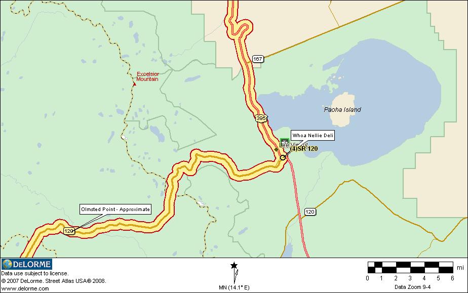
After we leave Olmsted Point, we will ride past a beautiful little lake (Tenaya) and out of Yosemite right at the top of the pass; that is, the eastern gate to Yosemite is the top of Tioga Pass at 9945 feet. Then we will drop down a little over 3000 feet over the next 12 miles to the junction with US395, Lee Vining and the Whoa Nellie Deli, our lunch stop:
Just before reaching the junction there is a gas station on the right called Tioga Gas Mart. In the store that is attached to the gas station is the Whoa Nellie Deli. It is run by Matt Toomey, a 4 star chef who moved his operation from the upscale ski resort of Mammoth Lakes to this location. Ever eat 4 star food in a gas station? You will here… Try the lobster tacquitos or the buffalo meatloaf. They are to die for.

After crossing over Monitor Pass, you will come to a stop sign and the junction with CA4. Markleeville, our next gas stop is to the right. Turn right, cruise a few miles into the tiny town of Markleeville with its one gas pump. Don’t worry, if you get impatient, there is another gas pump a few miles ahead. Place called Sierra Pines, I think. It’s on the left just before we reach Woodfords.
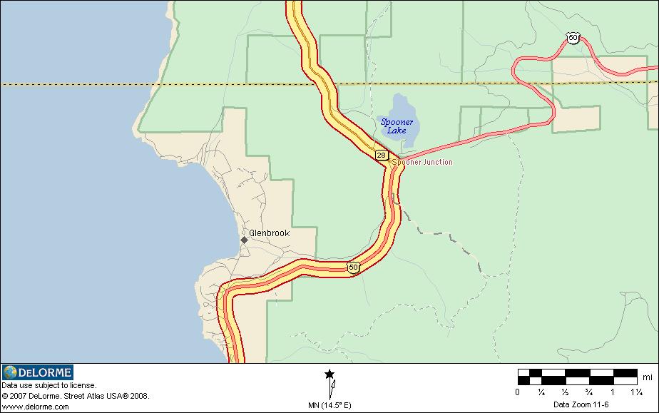
When we reach Woodfords, there will be a stop sign at the junction with CA88. Turn left there and head for Carson Pass on CA88.
All of the last three turns and the gas stop mentioned above are included in the next map: Onto 395, onto 89, Markleeville, onto 88.


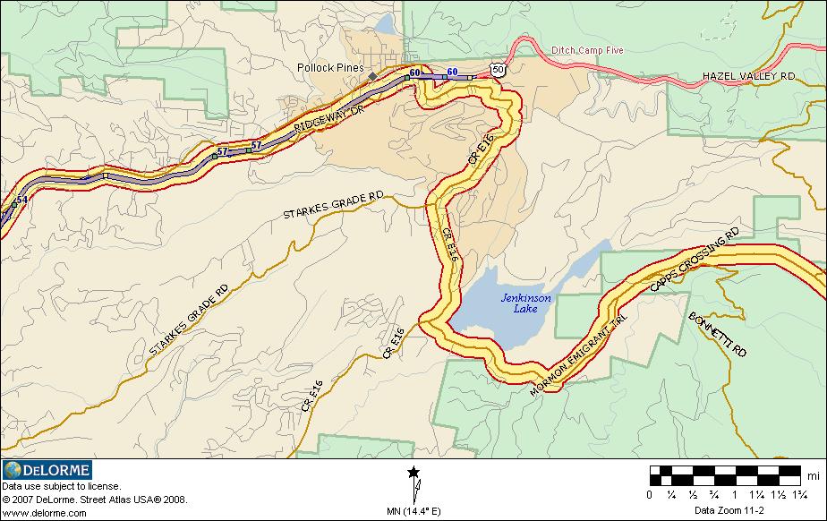
About 29 miles down the road, we come to lovely Jenkinson Lake and a stop sign at County Road E16. We turn right here and head back out to US50. We cross under the freeway and take a left onto the west bound ramp to US50. Continue on through Placerville to Cameron Park. Exit at Cameron Park drive, left under the freeway and right at the light on Coach Lane. Continue on to the motel.
September [TBD] (Tuesday): Leave Cameron Park, CA 9:00 AM
- US50 east to the next exit. Cross the freeway and turn right on North Shingle Road. Continue on N. Shingle, Green Valley and Lotus Roads
- Head north (left)on CA 49
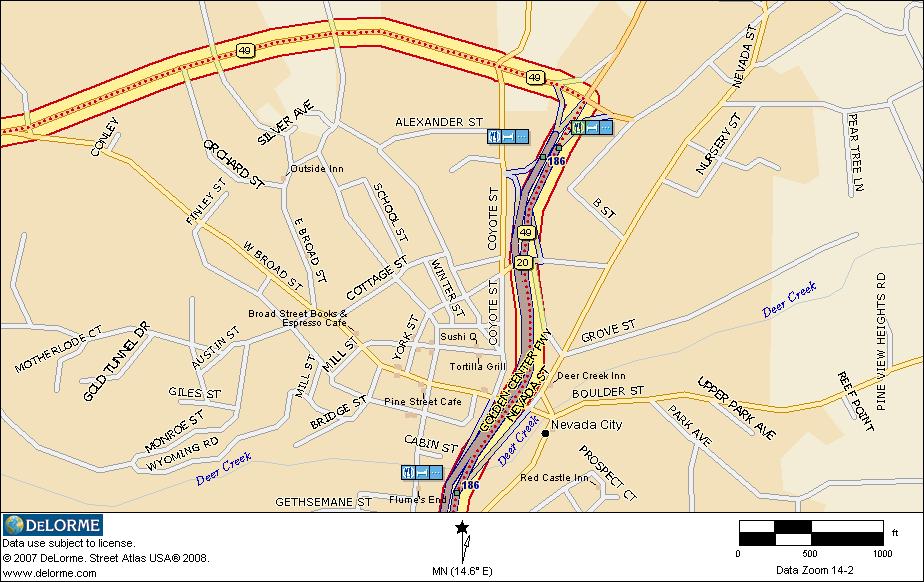
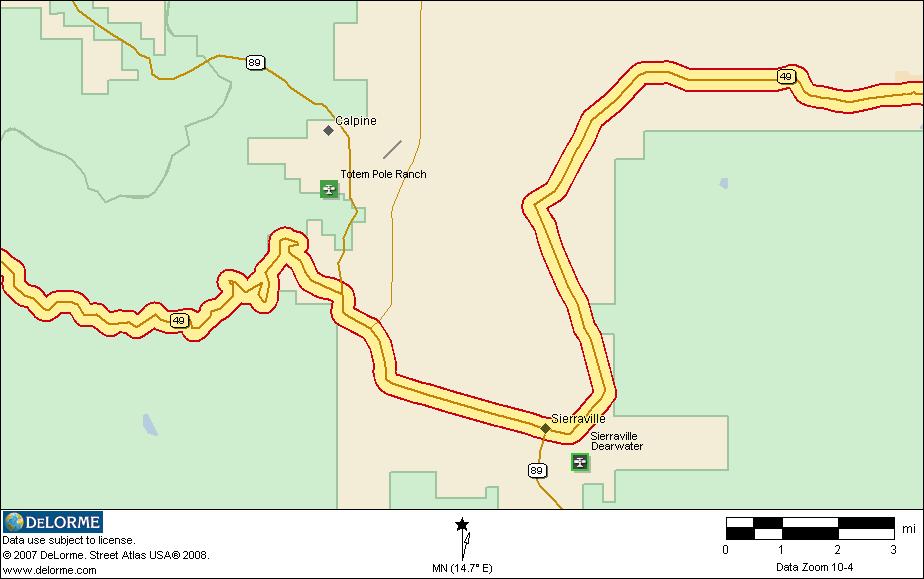
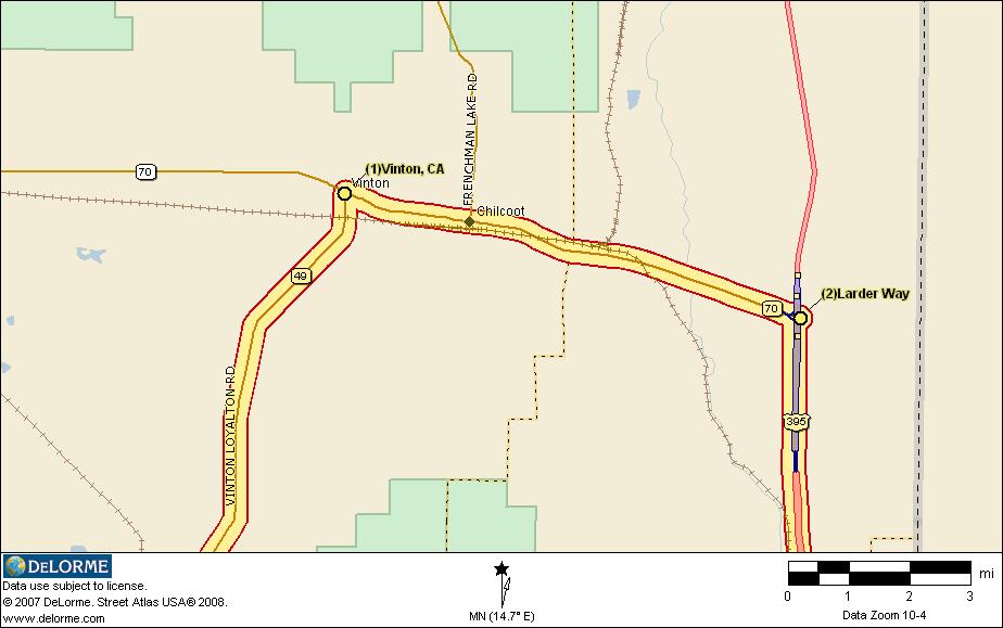
- Proceed north through Auburn and Grass Valley, Nevada City, Downieville to Vinton and the end of CA49.
- Lunch at Downieville at Two Rivers Cafe
- At Vinton, turn right onto CA70
- Gas at the junction with CA70/US395 – Shell station just beyond the 395 overpass.
- At the junction with US395, turn south on US395
- Continue on down US395 through Reno.
- At the exit for NV431 (Mount Rose Highway), depart US395.
- From there we will take NV431 to NV28. Left on NV28 to US50, right on US50.
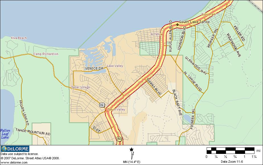
- We will skirt the eastern and southern shores of Lake Tahoe
- Pass through Stateline, the casino area at South Lake Tahoe.
- Proceed west on US50, taking the right lane past the Ag Inspection Station; we are “returnees” from the Placerville area and, as such, exempt (unless the signs direct otherwise… (Do not bring any fruit with you when leaving Placerville or when coming back into California)
- Continue west on US50, over Echo Summit, past Twin Bridges, through Kyburz and Pollock Pines to Camino.
- Exit US50 at Exit 54. Turn right onto Carson Road and continue on around to the left to our dinner stop for the day.
- After dinner, we will continue west on Carson Road until it rejoins US50.
- Exit US50 at Cameron Park Drive, turn left under the freeway and right at Coach Lane go get back to the motel.
- Distance: 321 miles (8-9 hours*)
- Gather for dinner at 7PM at Forester Pub and Grill in Camino, CA. (We will stop on our way back at this location.)


Continue north on North Shingle Road for 4 miles. At that point, the road changes names to Green Valley Road. About a half mile after becoming Green Valley, the road turns left and becomes Lotus Road.

Continue north through Pilot Hill and Cool. Descend into the American River Canyon to the stop sign on the north end of the bridge. Turn left and head up the hill into Auburn. In Auburn, there is a stop light at the top of the hill. Go straight through it. The road swings to the left and there is another stop light at Elm Avenue. Turn right on Elm. Cross over the freeway (I80), to the fourth light. The fourth light is CA49; turn right (there is a Foster’s Freeze restaurant across the street when you get to the correct intersection. All four lights are fairly close to each other.


The map segment above shows the start and finish of the days ride and the routes from and to the motel from US 50.
September 10th (Wednesday): Leave Cameron Park, CA 9:00 AM
- Head east on US50
- Ride to Lake Tahoe via Echo Summit
- Be careful of the pullouts on the Echo Summit downgrade to Lake Tahoe. They are very short and will only hold a few bikes. There are several of them so if the first one is crowded, go on to the next. The road is narrow so do NOT spill out onto US50.
- Proceed past Lake Tahoe into Nevada
- Turn left on Nevada 28
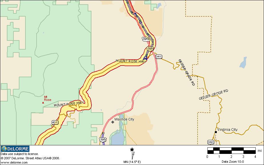
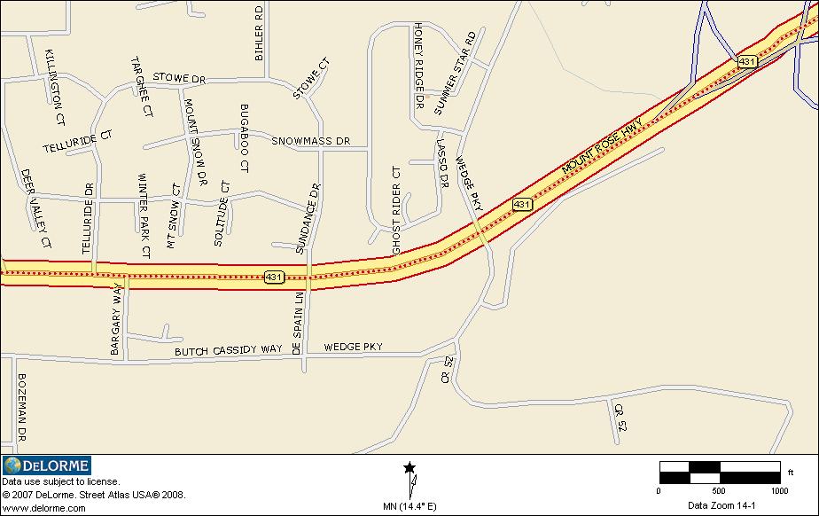
- Turn right on Nevada 431 (Mt. Rose Hwy) at Incline Village
- At the foot of Mt. Rose Highway, stop for lunch at the shopping center at the light before US395; the street is Wedge Parkway
- There are several fast food restaurants available at that center.
- Cross US395 where the road becomes Nevada 341 (Geiger Grade Road)
- Stop at Virginia City to sight see.
- Continue on through Virginia City to the junction with US50. Turn right (west) toward Carson City.
- Just before Carson City, stop for gas.
- In Carson City, turn south on US395.
- Turn right on Jack’s Valley Road in Carson City and continue on to Genoa, Walley Hot Springs
- After Genoa, Jack’s Valley Road has another name and it is Nevada 206.
- Return via Woodfords, CA88, Mormon Emigrant Trail, Sly Park Road and US50 to Cameron Park
- Distance: 266 miles (6-8 hours*)
- Gather for dinner at 7PM at the Zac Jack’s Bistro at the end of Coach Lane (behind Applebee’s)(walk/short ride from the motel).


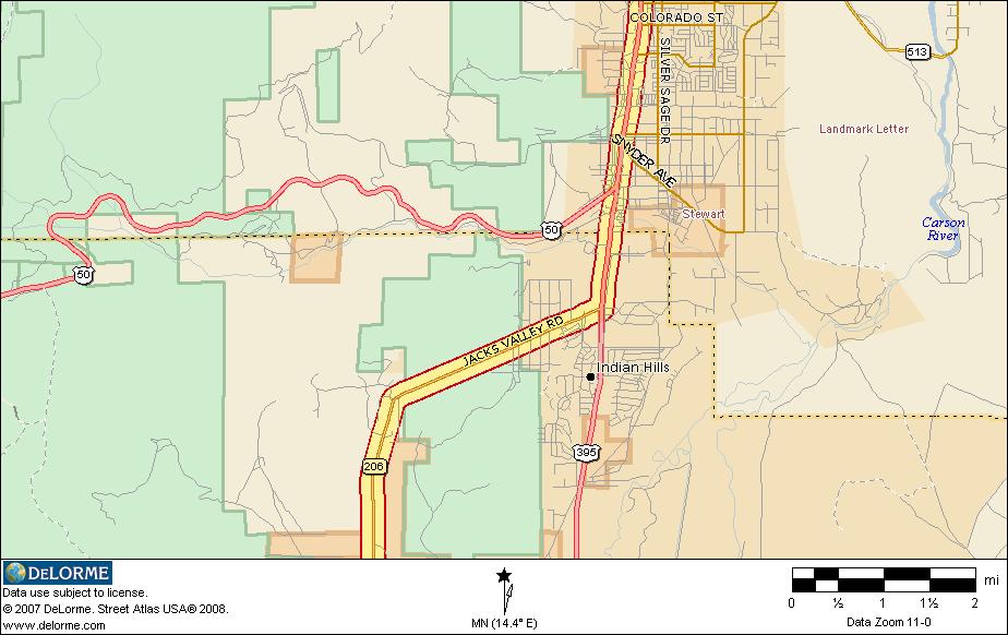
After filling up, we will continue west on US50 to the junction with US395 in Carson City. Turn left onto US395/US50. Just beyond the junction with US50, we will turn right onto Jacks Valley Road, NV206. The

We will continue on through Woodfords, through Hope Valley, over Carson Pass, past Caples Lake and Silver Lake to the junction with Mormon Emigrant Trail.

September [TBD] (Thursday): Leave Cameron Park, CA 9:00AM
- Head east on US50 to Pollock Pines and the Sly Park Exit; turn right on Sly Park Road to the junction with Mormon Emigrant Trail
- Turn left onto Mormon Emigrant Trail and continue on to the junction with CA88. Turn left on CA88.
- We will take CA88 to CA89, go over Monitor Pass to US395.
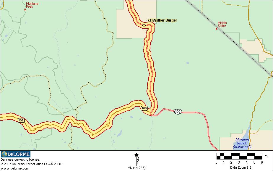
- Turn right (south) on US395, heading for Walker where we will stop for gas and lunch at Walker Burger.
- After lunch, we will head for Sonora Pass and the town of Sonora beyond.
- After leaving Sonora, we will cross the high bridge on the New Melones Reservoir and head for Angel’s Camp.
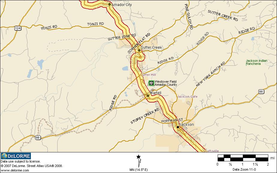
- We will go through Angel’s Camp, San Andreas, Mokelumne Hill and into Jackson.
- We will continue on CA49 to Placerville to the junction with US50. Turn west on US50 to Cameron Park and to the motel.
- Distance: 306 miles (6-7 hours*)
- Gather for dinner at 7PM at Papa Gianni’s Ristorante, Cameron Park (walk/short ride from the motel)


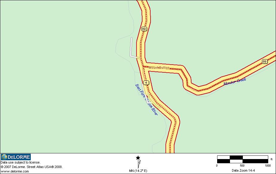
We will turn right (west) onto CA108 and head for Sonora Pass.

We will stay on Business 108 (Mono Way), bypassing the bypass. The old portion of Washington Street in Sonora is worth the price of admission: heavy traffic. About half way through town on Washington Street, we intersect CA49. It continues on north with us on Washington Street.


September 12th (Friday): Leave Cameron Park, CA 9:00AM
- Head east on US50 to the next exit. Take Mother Lode Drive (straight through the light at the end of the off ramp) to Pleasant Valley Road.
- Take the right side of the fork at Pleasant Valley Road and go to the stop sign in El Dorado (at Poor Red’s) and the junction with CA 49.
- Head south (right) on CA49 to Angels Camp
- Turn left on CA4 and cross over Ebbetts Pass; caution this road is one wide lane near the top.
- Proceed to the junction with CA89.
- Turn right on CA89 over Monitor Pass.
- Lunch at Walker Burger
- Proceed north on US395 to CA89, back over Monitor Pass
- Turn right (north) at junction with CA4, go through Markleeville to Woodfords
- Turn left at Woodfords on CA89/CA88.
- Continue on CA88 over Carson Pass
- Stay on CA88 all the way to Jackson
- Turn north on CA49 at Jackson and proceed to Placerville and the junction with US50.
- Head west on US50 to Cameron Park and the Motel.
- Distance: 314 miles.
- Gather for dinner at 7PM at Que Viva Restaurant (walk from the motel)


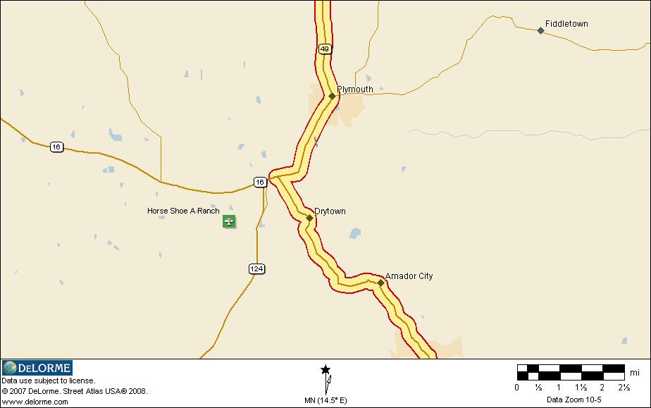
We continue on CA49 south through Plymouth to the junction with CA16. CA49 takes a left turn here as shown in the map below.

After our break, we will continue on over Ebbetts Pass. Please exercise extreme caution in the upper sections of Ebbetts Pass as the road is a wide one lane road at that point. I have often encountered SUVs hogging the road up here so PLEASE be watchful.
At the bottom of Ebbetts Pass, we will encounter the junction with CA89. Turn right on CA89 and proceed up Monitor Pass.
(If you miss this turnoff, you will end up in Markleeville.) Just past the top of Monitor Pass is a spectacular overlook. We will stop there for photos and another butt break. The pullout for the overlook is through oncoming traffic so be careful as you cross the highway.
At the bottom of Monitor Pass, we come to a stop sign at the junction with US395 (CA89 ends here). Turn right (south) on US395 and proceed to Walker and Walker Burger where we will stop for lunch and gas.
After lunch and gas, we will head back the way we came, along US395 north. We will turn onto CA89 and retrace our steps over Monitor Pass. If you missed the overlook on the way down, you will have a chance to catch it on the way back.
When we reach the stop sign at the junction of CA4 and CA89, turn right and head for Markleeville. We will continue on through Markleeville to Woodfords and the junction with CA88.
At the stop sign at the junction of CA88 and CA89, turn left onto CA88. We will continue on CA88 past the junction with CA89 and head over Carson Pass, past Caples Lake and Silver Lake.
Instead of turning on Mormon Emigrant Trail, we will continue on CA88 all the way to Jackson. At the junction of CA88 and CA49, we will turn right onto CA49. We will retrace our steps, following CA49, through Martell, past Sutter Creek and Amador City, through Plymouth to El Dorado. At the stop sign in El Dorado, we will turn left onto Pleasant Valley Road and retrace our steps down Pleasant Valley Road. At the stop sign at Mother Lode Drive, we will turn left onto Mother Lode Drive. At the stoplight by the Exit 37 off ramp, we will turn right, cross the freeway and take the clover leaf onto US50 westbound.

September 13th and 14th (Saturday and Sunday):
- Gather for dinner at 7PM on Saturday at Round Table Pizza, Cameron Park (walk from motel)
- Featured Side Ride: Loon Lake via Lotus Road, Marshall Grade Road, Wentworth Springs Road, Ice House Road, back on US50.
- Return home Sunday…
* – depending on how fast or how slow you take the curves.
What to expect on the ride…
In addition to a week of great motorcycling, wonderful camaraderie, a lot of nice people having a good time, lots of good food, lots of beautiful scenery, you can most likely expect the following during the ride:
Weather:
The weather will most likely vary from very hot in the low foothills (90F and up) to quite cool at 9,000 feet or better in the mountains (probably in the high 40s or low 50s) Layers will help a lot. This is generally a dry time of year in the western foothills but rain showers in the mountains or on the eastern slope are a definite possibility. Having some rain gear with you is a good idea.
Traffic:
The traffic is generally light except through urban areas. And in this case, the urban areas are very small (10,000 people or less).
Road Conditions:
There could be spots of construction along the way. No significant delays are expected.
The roads are very twisty and winding (yesssssss!!! – great for motorcycles!!). You need to bring your cornering skills with you and to take it easy if you think the road is getting to be too much for you. There is enough time to make our destinations at even at a slower pace. Don’t hurry! Take your time and enjoy! Above all, RIDE YOUR OWN RIDE AT YOUR OWN PACE. I can’t emphasize this strongly enough!
Motorcycle Dealers along the way:
This could be spotty. There will be dealers in Auburn, Carson City, Sonora, Jackson and that is probably about it for the routes we are taking. We will get into some fairly remote areas.
Questions:
If the preceding raises any questions, or if you have questions on anything else, please email me: Douglas Van Bossuyt